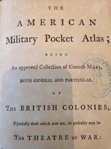
Title Page of the American Military Pocket Atlas
The American Military Pocket Atlas, printed in 1776 in London, is an interesting item to peruse. On the outside it looks like a regular book, if maybe a little inflated. Tucked inside its bursting pages, however, are 6 full-size maps, ranging in size from 17 x 12 inches to 26 x 19 inches. Sometimes called a “holster atlas”, these atlases were made for British officers going to war in the American Colonies during the Revolutionary War. The officers would carry the books in their pockets or on their belts, hence the name “holster”. It must have been quite a feat to fold so many big maps down to a portable size – something evidenced by the expanded shape of the book, the uneven pages, and the worn edges and folds of the maps themselves. This particular atlas was printed for Sayer & Bennett, who were major map and print sellers on Fleet Street in London. They were official partners between 1776 and 1784.