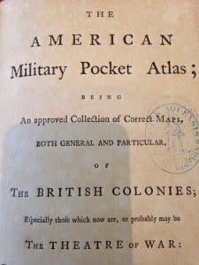
Title Page of the American Military Pocket Atlas
The American Military Pocket Atlas, printed in 1776 in London, is an interesting item to peruse. On the outside it looks like a regular book, if maybe a little inflated. Tucked inside its bursting pages, however, are 6 full-size maps, ranging in size from 17 x 12 inches to 26 x 19 inches. Sometimes called a “holster atlas”, these atlases were made for British officers going to war in the American Colonies during the Revolutionary War. The officers would carry the books in their pockets or on their belts, hence the name “holster”. It must have been quite a feat to fold so many big maps down to a portable size – something evidenced by the expanded shape of the book, the uneven pages, and the worn edges and folds of the maps themselves. This particular atlas was printed for Sayer & Bennett, who were major map and print sellers on Fleet Street in London. They were official partners between 1776 and 1784.
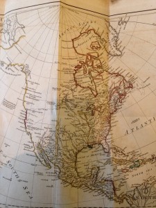
Map of North America by Samuel Dunn
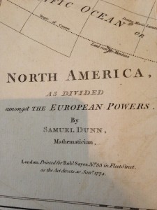
Detail of Samuel Dunn’s North America Map
The six maps in this atlas cover a comprehensive area of the American Colonies of the time. Most of the maps are hand-colored, to show borders, territories, and bodies of water. The first map is an overview of all the portions of North America held by European Powers (including the British) in 1776. Coincidentally, this map is also the smallest in the atlas. Samuel Dunn is the creator of this map.
The other maps include the West Indies (Samuel Dunn), the Northern Colonies (Governor Pownall, Major Holland, and others), the Middle Colonies (Governor Pownall, among others), the Southern Colonies (Bernard Romans, Captain Collett, Mouzon, De Braham, and others), and finally, a map of Lake Champlain (William Brassier). The oldest map in the collection, that of Lake Champlain, is from 1762. Governor Pownall’s maps are from 1776. Most of these maps indicate that they are revisions, updates, or corrections to earlier maps, hence the large number of names included upon each one. The map of the Northern Colonies was published by the Board of Trade. All sorts of people were involved in map-making during this time. Samuel Dunn for instance, who made two of the maps in this atlas, was a mathematician, teacher, and amateur astronomer. His interest in maps came from astronomy and the use of star charts, which he often included in the maps he made. Another person involved heavily in this particular atlas was Governor Thomas Pownall – the atlas is actually dedicated to him. He was an extensive traveler in the Americas and contributed a lot of survey information to many maps of the time. Interestingly, he was also somewhat heavily involved in the Revolutionary War, supporting the colonies up until the time hostility broke out in 1775.
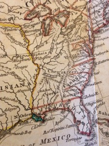
Hand Coloring Detail of Samuel Dunn’s North America Map
Holster atlases and other pocket-sized maps were incredibly useful, especially for travelers or other people on the move – like soldiers. Instead of having to carry around bulky rolled-up maps or individually folded maps, people had quick access and portability with a small book of maps. Of course, there were also disadvantages to this form of atlas. Besides the obvious weather damage any map can take out on the field, the constant unfolding and refolding of the maps, on top of being compressed by other maps and the book binding, greatly reduced the lifespan of many of these holster atlases. Luckily, at least some of the maps in the American Military Pocket Atlas were treated to a different type of printing process. They were cut and pasted onto linen, in order to make the folds more durable.
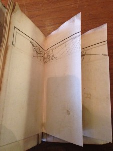
A folded map
The American Military Pocket Atlas is a fun and interesting example of how diverse books can be. This atlas contains more maps than it does pages, yet is bound to look just like a regular book from the outside. Folded maps and pocket maps have continued to be a popular and useful commodity even in the modern age, as virtual maps slowly take over.
WORKS CONSULTED
http://www.britishmuseum.org/research/search_the_collection_database/term_details.aspx?bioId=108517
The Ambulatory Map: Commodity, Mobility, and Visualcy in Eighteenth-Century Colonial America by Martin Brückner